At home
Home notes & records
A room update, a household reference or the details someone needs while you are away.
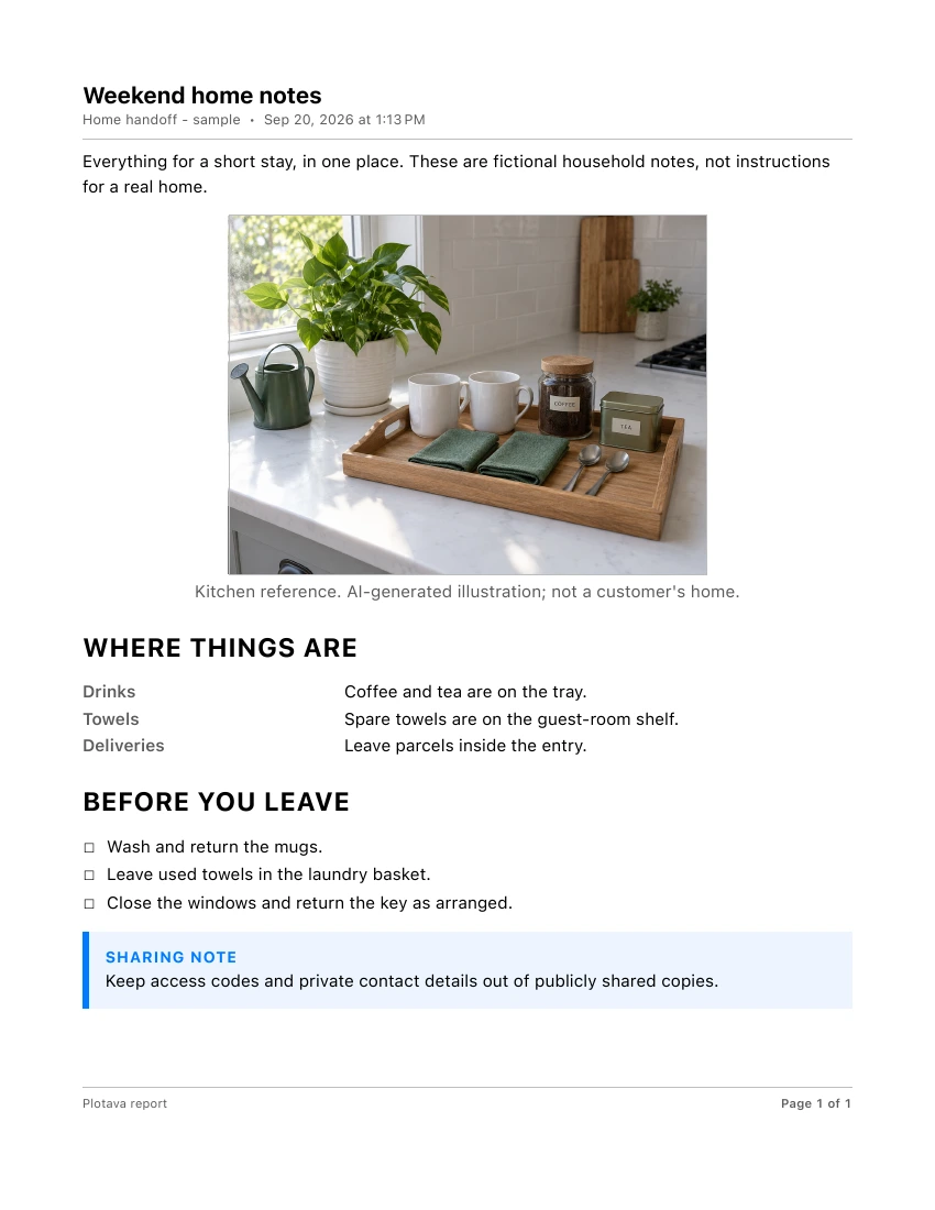 1-page PDF / Pages OnlyOpen the home notes PDFSee how to make it
 PlotavaDownload
PDF & DOCUMENT MAKER / IPHONE + IPAD
Turn photos, notes and PDFs into documents people can follow.
Create your own pages. Bring in existing material. Keep the useful details connected, then share a PDF without rebuilding the record somewhere else.
No sign-up. No ads in the app. One binder at a time is free.
FROM SCATTERED DETAILS TO A USEFUL DOCUMENT
A setup worth explaining. A room worth documenting. A job that needs a clear handoff. Start with a Report, photos or an existing PDF, not a blank desktop later.
WHAT WILL YOU MAKE?
At home
A room update, a household reference or the details someone needs while you are away.
1-page PDF / Pages OnlyOpen the home notes PDFSee how to make itExplain a process
Show the setup, add the steps and give the next person a useful reference.
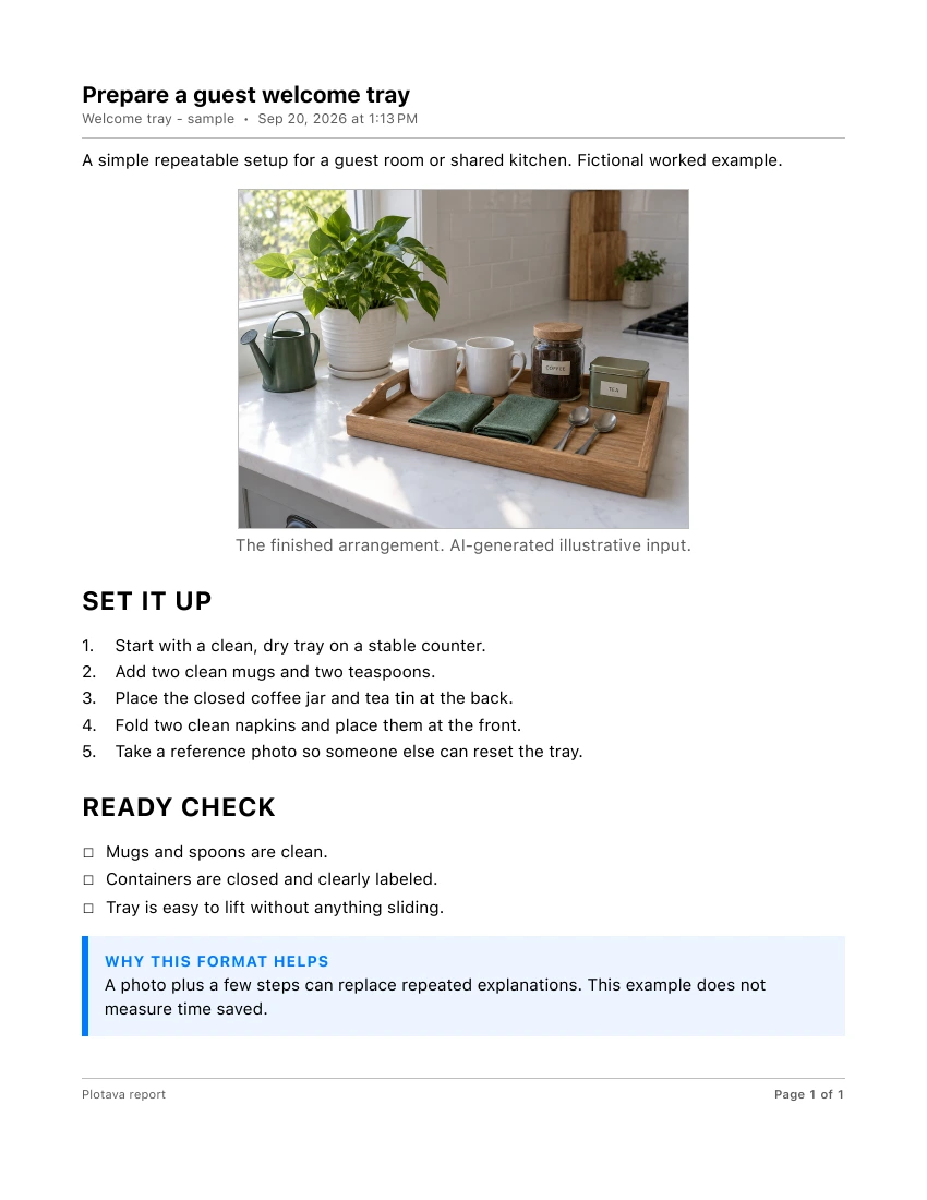 1-page PDF / Pages OnlyOpen the illustrated guide PDFSee how to make it
For your work
Keep observations, marked-up photos and the place they describe together for the next person.
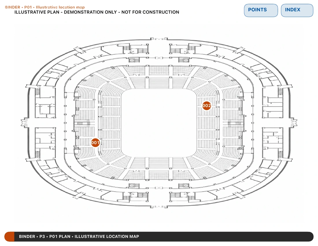 9-page PDF / Complete BinderOpen the linked work record PDFSee how to make it
Actual Plotava exports with fictional example content. The household illustration is AI-generated input, not a customer photo. These are examples to inspect, not additional bundled templates.
IN THE APP
A Binder keeps your own Reports and imported material together. Points add supporting detail when you need it; they are optional for a simple document.
Start from a template or Blank Report. Add photos, steps, checklists and your own words.
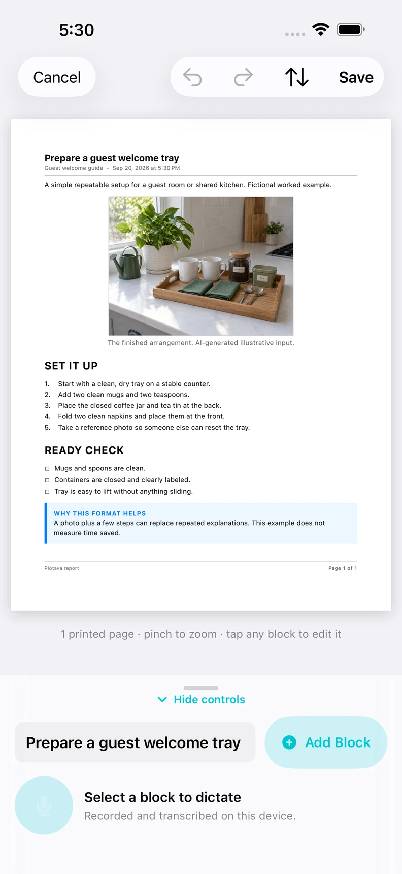
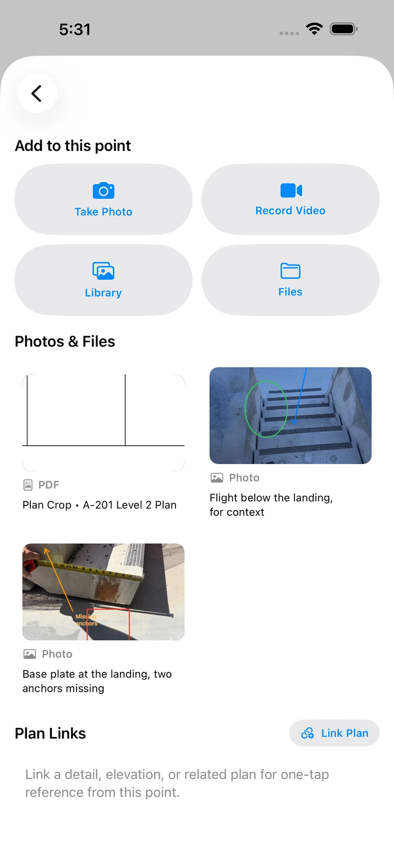
Attach photos and files to a Point. Mark up the important part so the next person can find it.
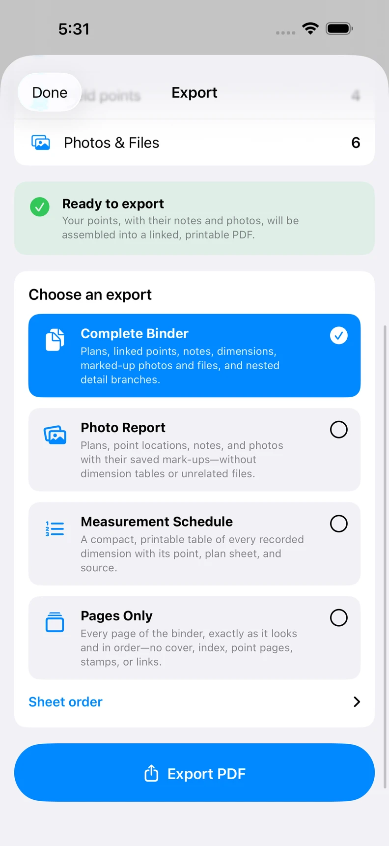
Choose Pages Only for a simple document, or Complete Binder for linked pages and supporting detail.
CHOOSE YOUR VERSION
The document-creation experience shown here is available in iOS version 1.2.0. Create Reports, scan pages, use Dictate, keep Recordings and choose Pages Only or a linked Complete Binder.
Tidy Text requires iOS 26, compatible Apple Intelligence hardware and Apple Intelligence enabled. Other features do not require Tidy Text.
Plotava is also on Google Play for the core plan-linked photo, markup and PDF workflow. It does not yet include the iOS Report creator, Dictate, Recordings, document scanner, Pages Only or User Guide shown on this page.
Get the Android version on Google PlayFREE TO DOWNLOAD. USE IT FOR REAL.
One binder at a time is free, with everything in it. Finish it, export the PDF, delete it, start the next. Pro keeps unlimited binders on this device.
FREE
$0
Use the full iOS workflow in your one personal Binder, including PDF export. No trial clock and no export paywall.
PLOTAVA PRO
Monthly or annual
Keep unlimited Binders on this device. Current price and renewal terms are shown in your store before purchase. Pro does not add automatic cloud sync.
Before deleting a Binder you may want to edit again, save a Binder Backup. A PDF is a sharing copy, not an editable backup. Manage an optional auto-renewing subscription in your store account.
BEFORE YOU START
No. Start a Blank Report or a template such as Work Instructions, Photo Log or Meeting Notes. A plan is one possible source, not a requirement.
Plotava lets you author Report text and mark up imported pages. It does not edit the original text in an imported PDF, perform OCR, convert Word documents or create fillable forms.
Complete Binder keeps navigation between source pages and connected detail. Pages Only exports just the pages without navigation links. Recordings are separate files when shared alongside the PDF in a ZIP; audio and video are not playable inside the PDF.
On your device, unless you choose to share or back them up. Plotava has no account, in-app ads or silent product analytics. There is no automatic Plotava cloud sync. Optional imagery, address search and purchases need a connection.
Yes. Export the finished PDF, save an editable Binder Backup if needed, then delete the Binder from the app to start the next. The free offer is one at a time, not one in your lifetime.
ONE USE CASE: PLAN-LINKED EVIDENCE
This earlier iPhone recording shows the original plan-to-photo workflow. Screens and labels have changed since recording; the current version also creates Reports without a plan.
STEP 1 OF 6
Start from the plan your team already uses. Plotava preserves the original and makes the plan the index for the field walk.
PLOTAVA
Your next illustrated guide, home record or work report can start with the material you already have.
Free download. No sign-up. One binder at a time is free.